Harvey Rural Community, known as Harvey RC, established in 2022, boasts a region of over 10 lakes and numerous waterways. Often referred to as a “land of lakes,” it attracts both seasonal and permanent residents. Some lakes serve as residential areas, others remain untouched by human habitation. Today, the lakes primarily serve recreational purposes- a sanctuary for leisure and relaxation. However, their history extends far beyond mere enjoyment. In the past, these lakes were vital resources for indigenous communities, serving the original inhabitants for sustenance and essential travel. As settlers began to arrive, the lakes and their interconnected waterways played a pivotal role in supporting their livelihoods. They provided not only food but also hydro power for sawmills, woolen mills, and grist mills. This calendar, capturing the essence of these lakes throughout time and tracing their remarkable stories through photographs, offers a glimpse into their rich history and enduring allure.
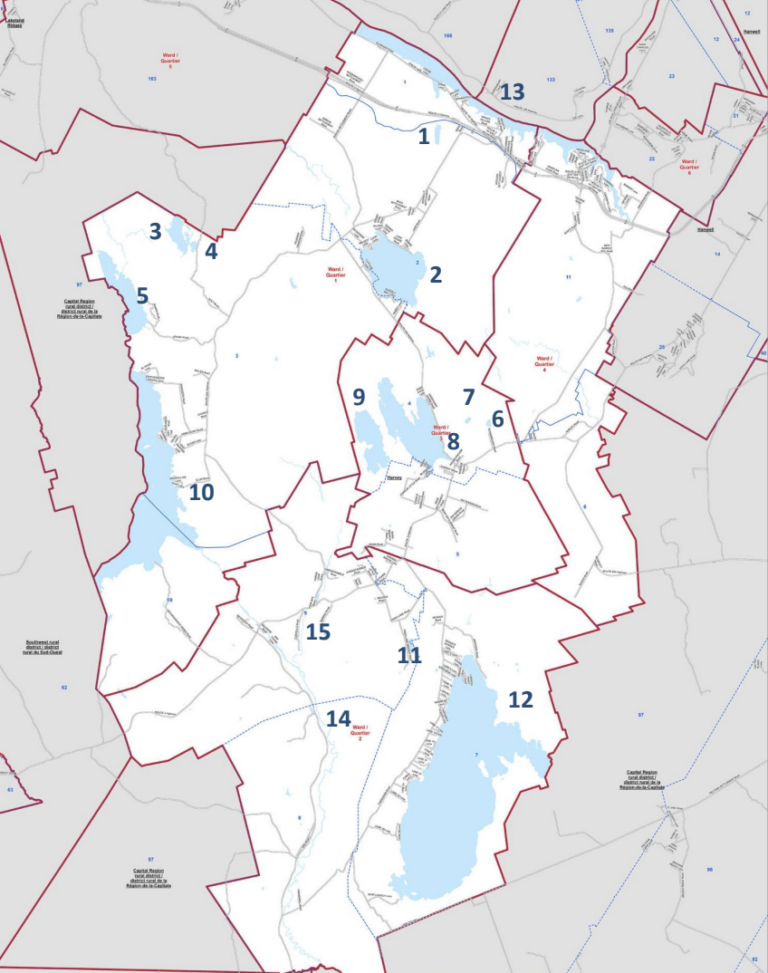
The map shows the lakes and the main rivers within Harvey Rural Community, highlighted by the white area.
1. Waterloo Lake
2. Lake George
3. Mud Lake
4. Clear Lake
5. Little Magaguadavic Lake
6. Rosborough Lake also known as Holland
Lake
7. Grieve Lake
8. Harvey Lake
9. Second Harvey Lake
10. Magaguadavic Lake
11. Frog Lake
12. Oromocto Lake
13. Wolastoq/Saint John River
14. Magaguadavic River
15. Northeast Branch Magaguadavic River
Map source: harveyruralcommunity.ca